We propose a novel physics-informed deep learning architecture for predicting radio maps over lunar terrain. Our approach integrates a physics-based lunar terrain generator, which produces realistic topography informed by publicly available NASA data, with a raytracing engine to create a high-fidelity dataset of radio propagation scenarios. Building on this dataset, we introduce a triplet-UNet architecture, consisting of two standard UNets and a diffusion network, to model complex propagation effects. Experimental results demonstrate that our method outperforms existing deep learning approaches on our terrain dataset across various metrics.
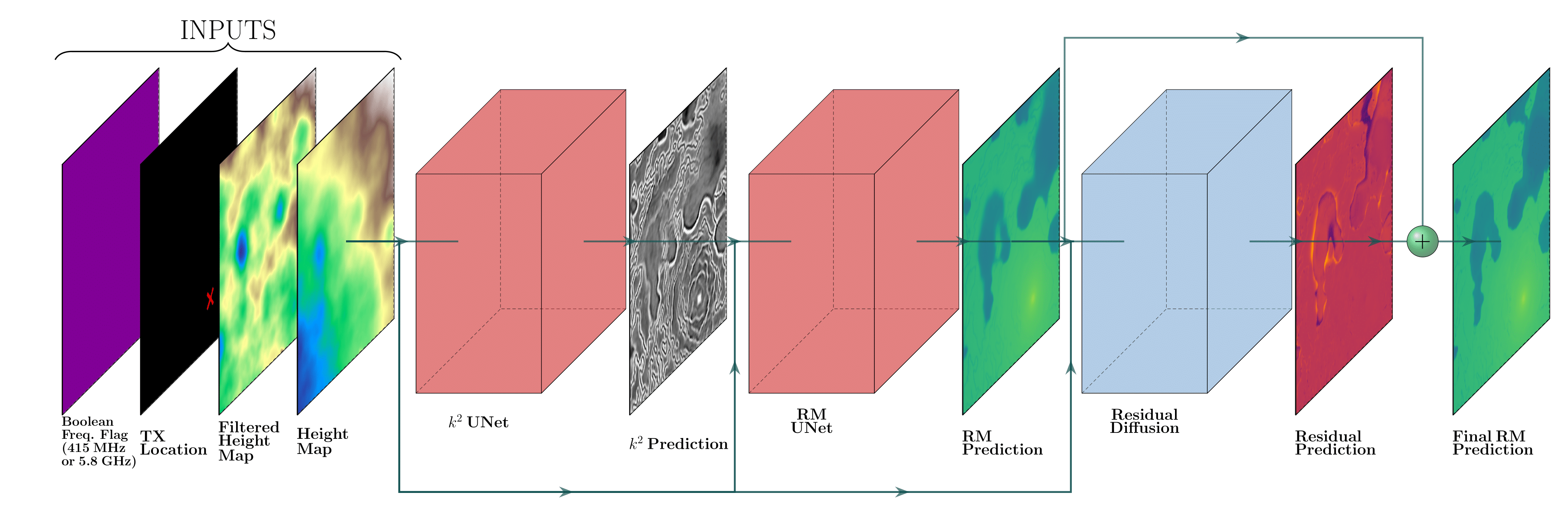
We propose a pipeline of three cascaded models—two UNets followed by a diffusion network (Fig. 2)—to predict a radio map \( I_{RM} \in \mathbb{R}^{H \times W} \). The input to the pipeline consists of: (i) a height-map image \( I_{HM} \in \mathbb{R}^{H \times W} \), (ii) a high-pass filtered height map \( I_{FM} \in \mathbb{R}^{H \times W} \), (iii) a one-hot encoded image indicating the transmitter location \( I_{Tx} \in \{0,1\}^{H \times W} \), and (iv) a boolean image \( I_{Hz} \in \{0,1\}^{H \times W} \) which is all 0 to indicate a 415 MHz model and all 1 for 5.8 GHz.
We created a custom synthetic lunar terrain generator based on real metrics from NASA lunar exploration. Raytracer Sionna is used to simulate wireless signal propagation in these synthetic lunar terrains.
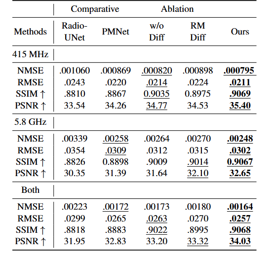
We compared our method RadioUNet [1] and PMNet [2]. Experimental results demonstrate that our method outperforms existing deep learning approaches on our terrain dataset across various metrics. We evaluate pixel-wise performance using the root mean squared error (RMSE), normalized mean squared error (NMSE), structural similarity index (SSIM) and peak signal-to-noise ratio (PSNR).
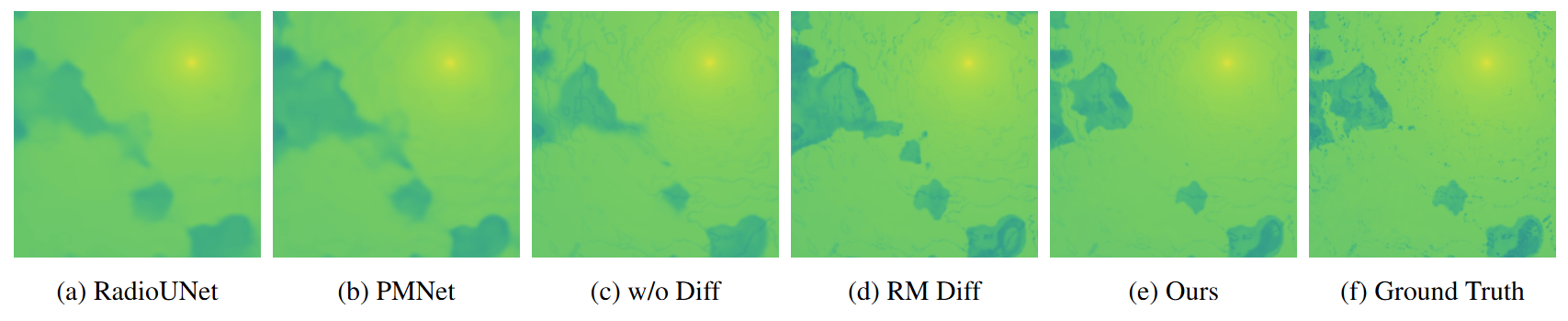
Our predictions preserve fine geometric details and accurately localize electromagnetic singularities, especially in low-connectivity regions such as craters and terrain shadowed by hills. In contrast, the baseline methods tend to blur sharp features in the radio map or misplace singularities, leading to degraded interpretability and less reliable coverage prediction.
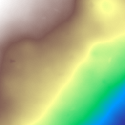
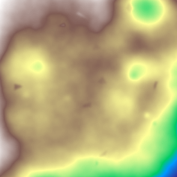
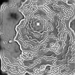
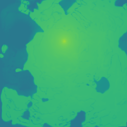
The following are samples from our dataset showing the lunar terrain generator output and the raytracer output for wireless signal strength. The red cone identifies the position of the transmitting antenna. The map can be rotated for viewing. We also included dashboards of the input and output prediction of our neural network architecture.